April 27th – May 5th
On this trip I took with me two pairs of Keen hikers – The Terradora and the Terradora Mid Waterproof Boot.
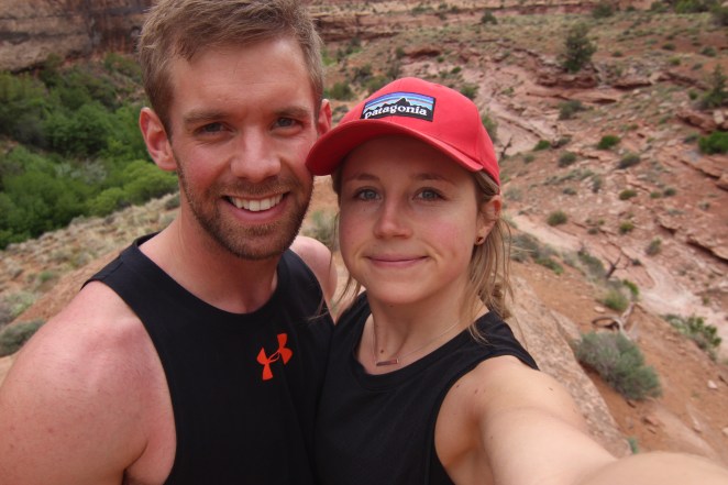
I had been to Utah a couple years before, though I had never been to the Moab area, so I figured why not make this the year to do that! My boyfriend Craig and I set off for a one week post graduation trip. We didn’t realllyyyyy have a plan but we had some sort of outline for what we wanted to do with the 8 days on the road. Utah can be slightly overwhelming, as there is SO much adventure in the state, whether you are into hiking, mountain biking, kayaking, rock climbing, ‘ATV’ing’ and more. We had just planned to hike, but for those reading who are also into other activities, know that Utah is FULL of possibilities. Or perhaps you just want to go to relax (you can do that too), there are a number of campgrounds, restaurants, ‘pull-up’ attractions and places to just enjoy throughout.
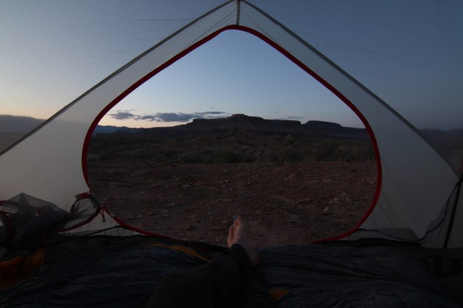
We left Alberta on April 27th, and started on our 14 hour (1,642km) road trip to Spanish Fork, Utah, where Craigs sister lives. We stopped there for a night before making our way to Moab the next day, another 2.5 hours South East. We ended up meeting up with friends who were also planning to camp, they had a site at Williams Bottom Campground, right along the Colorado River. They had brought their climbing gear so we decided to join them for a bit before heading out on an evening hike.
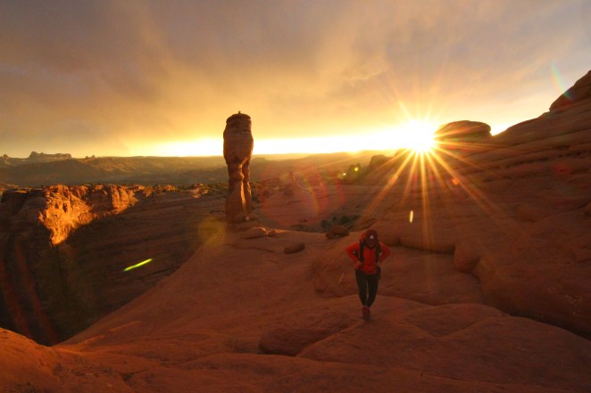
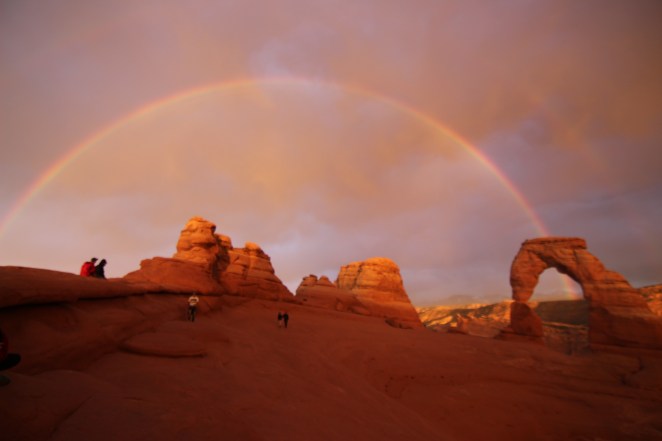
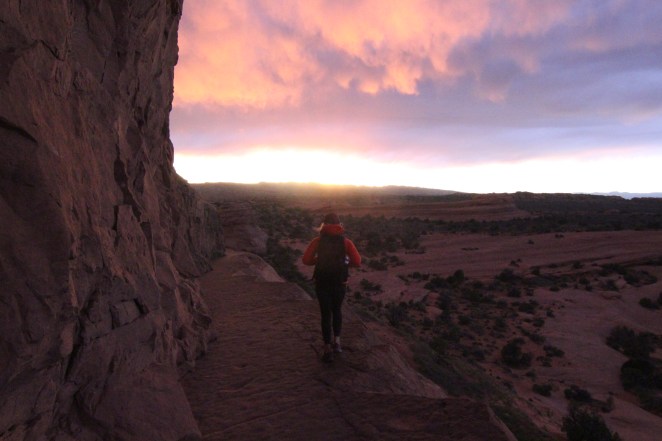
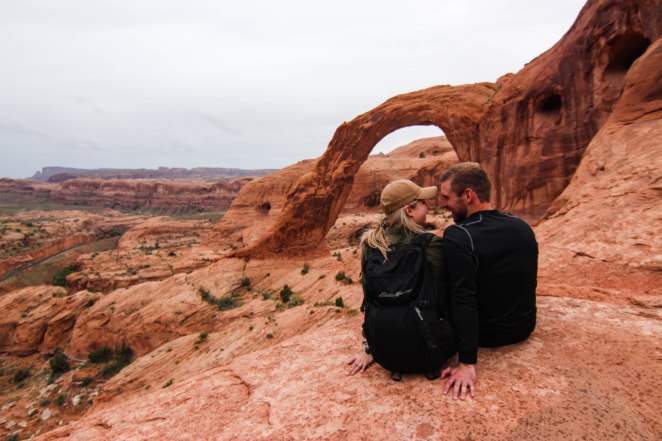
Delicate Arch, Moab – Arches National Park
We left for Delicate Arch at around 530, making our way into Arches National Park, where we picked up our South East National Parks pass, for $55.00 which allows us to get into Arches, along with Canyonland’s and Natural Bridges National Monument, the pass is good for one year. We began hiking at around 630. The trail is approx. 3.1 miles round trip, though 613ft elevation gain. We wanted time to walk around before the sunset, which we wanted to catch at the top! We ended up getting extremely lucky and experienced a rainbow above the arch before sunset. This was the perfect way to begin the trip.
I had many questions from people wondering which air bnb we stayed at in Moab, though it was Craig’s sisters cottage, just 15 minutes outside town. Having family in the area sure helps with accommodations, and it is nice to have a shower and a comfy bed after a long day of adventuring!
April 29th
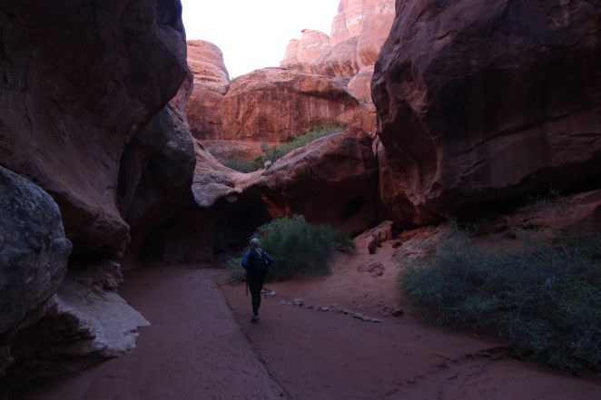
Negro Bill Canyon Wilderness Area – Grandstaff Trail & Corona Arch
We set off for a morning hike on Grandstaff Trail – approx 4.3miles round trip. The trail is rated as moderate. At the end of the hike to come to ‘Morning Glory Natural Bridge’. The trail was perfect for the morning, with only 387ft of elevation gain, and over a longer duration. The hike is perfect for people of all ages. The trail crisscrosses a river, so waterproof shoes would be recommended. Once we reached the Natural Bridge there were being repelling from it, so we were able to have a snack, watch them, and visit with some others before heading back out.

After that we went and hung out at our friends camp for a bit and relaxed, played cards and hit from some rain. We decided ‘why not head out on another sunset hike’, so at about 6:00pm we set out to hike to Corona and Bowtie Arch, one of the most popular hikes in the area, and for a very good reason. It’s a 2.3 mile out and back hike, with 469m of elevation gain. We were taking a risk with the weather, as it had been raining most of the afternoon and evening forecast was calling for a bit of rain but the clouds cleared and we set out! We got very lucky and ended up having great views of Corona Arch, where it just began to rain on the way out. Corona is a 140ft x 105ft opening.
Corona Arch

April 30th
Devils Garden Loop – Arches National Park & Mesa Arch – Canyonland’s National Park
The next day we decided to head back to Arches National Park to do a trail that came recommended by many, one that has a number of arches you cross along the way, Devils Garden Loop. With 7 arches during the hike, this is one that if you are in the area for a limited number of days or even just one, is a must do! The hike is 7.5 miles long and with 1,069ft of elevation gain, takes a bit longer then others but very much worth it. The trail is rated as difficult. There are some challenging sections in the middle of the loop that require a bit more confidence and skill level – moving up and down the rocks and if slippery it can be that much more challenging. The main trail is well maintained and wide. The first bit takes you to Tunnel Arch and Pine Tree Arch, and then on to Landscape Arch (pictured below).
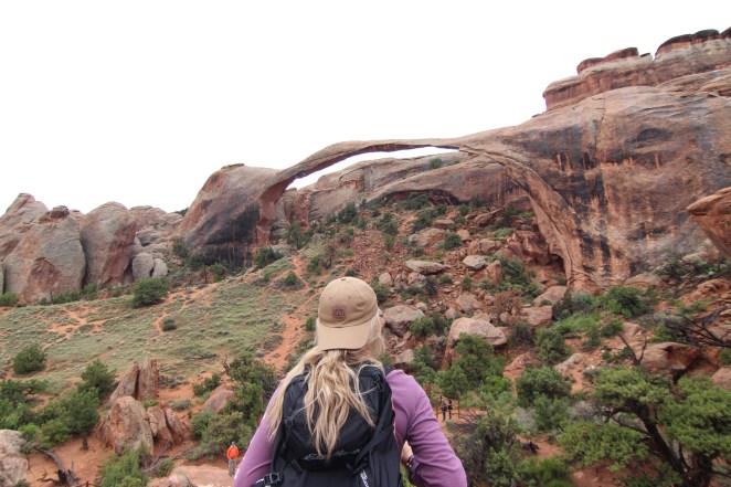
Landscape Arch
The trail then leads you to Wall Arch, then have the option to take a spur trail to Navajo Arch or Partition Arch. From here you can retrace the main trail back or continuing from there to Double O’ Arch (pictured below) and Dark Angel.

Double O’ Arch
Some people choose to do the trail the other direction (counter clockwise) if they are uncomfortable with some more difficult sections and do the other direction as far as they can. We came across some taking this option.

The same evening we decided to head to Canyonlands National Park for the evening to visit another arch and to watch sunset. We stopped for a view of the canyon (pictured below and then headed to the famous ‘Mesa Arch’, a heavily trafficked trail of 0.6miles and 62 feet of elevation gain. Even though we went in the evening, this spot is most popular at sunrise, due to the sun rising just behind the arch, and because of its accessibility.
Canyonlands

Mesa Arch
Once done at the Mesa Arch we headed for ‘Island in the Sky’ (pictured below), not very far down the road from Mesa Arch into Canyonlands, where we wanted to take in the sunset, but due to crazy winds/weather we didn’t last too long and ended up driving back to Moab a bit earlier, telling ourselves we would come back next day when enjoying it was a bit easier. If you continue reading you will see photos from here!
May 1
Firey Furnace – Arches National Park / Upheaval Dome – Canyonlands National Park
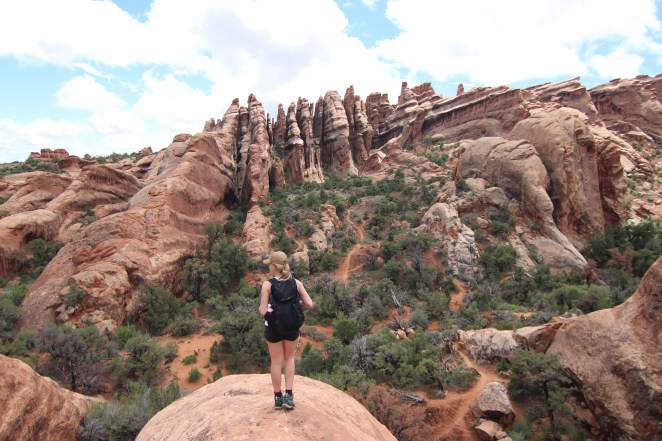
When we arrived in the Moab area we had went straight to the visitor centre to make sure we got a ‘down-low’ of the main things to do in the area and to get any permits we may have needed. We were told that the ‘Fiery Furnace’ in Arches National Park is one of those musts, and it’s weather dependent. We knew we were in the area for a few days so looked ahead at the schedule and booked it for 9:00am on May 1st. This was SUCH a unique experience – it’s like an adults playground. You could spend HOURS exploring throughout the fiery furnace. At the visitor centre they will have you sit down and watch a video of the area before you can go in, talking about rules and regulations in the furnace (what to watch for, where you can and can not go), about the vegetation etc in the area. You can sign up for a guided tour OR explore on your own, we decided to explore on our own.
Fiery Furnace


We headed for lunch before going back to Canyonlands National park. We wanted to hike around Upheaval Dome, so we headed there first. We started via the Crater View trailhead. It’s a 1.5 mile out and back trail, with 301ft of elevation gain (to the main viewpoint), though we decided to continue a lot further down the trail and take in more views. After hiking for a couple hours round trip, we had decided the best views were at that first viewpoint. If you are short on time or don’t want to hike far the first view point should be your end point, though me being me, I usually like to make it longer, getting steps in, and since we had so much time. The first view point gives you spectacular views of a geological formation – a mile wide crater of mysterious origins, perhaps formed by a meteorite. Worth the visit! Craig found this place to be one of his favourites from our whole Utah trip!

Upheaval Dome
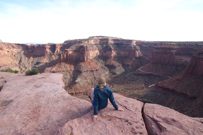
After this hike we headed back to ‘Island in the Sky’ to watch sunset (pictured below). You can pull into the parking lot and you can walk up to this viewpoint. The sunset was unbelievable. I didn’t want to leave! We found a quiet place to sit and take it all in.
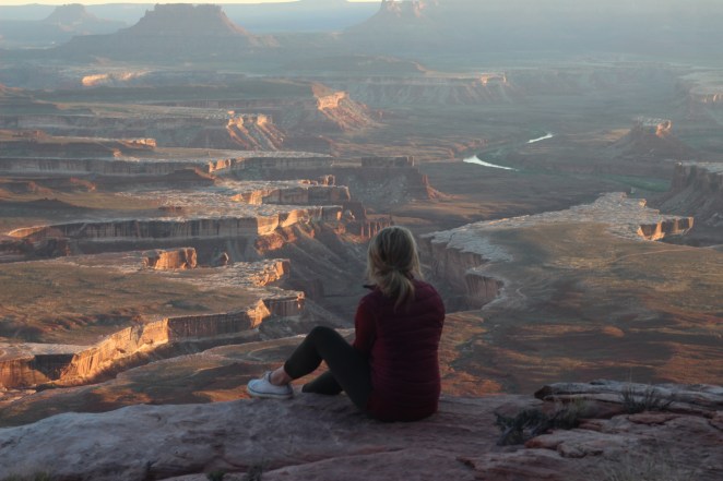
Island in the Sky
We planned to stay at the campground in Canyonlands, though all sites were booked, so after sunset we ended up driving 4 hours to Bryce Canyon National Park, and pulled into a campground there last minute. I don’t advice driving this road through the night if you do not have to due to the large amount of deer on the road, but we were eager to get to a new National Park! Again we werent really sure of our schedule but this ended up working well!
May 2nd
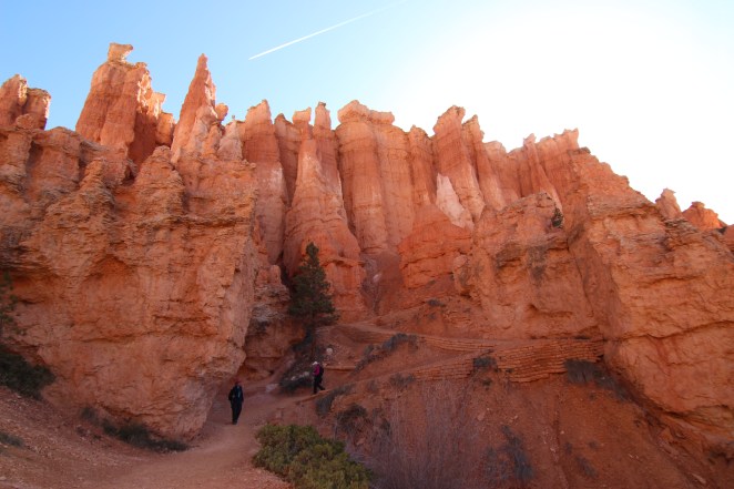
Bryce Canyon National Park
This was my second time visiting Bryce Canyon National Park. LOVE it here!
We woke up early, checked out of our campsite (we camped just outside the park) and headed for the park. I don’t think we could have covered any more ground in Bryce even if we tried. The most popular little hike in Bryce was closed for maintenance (Navajo loop) so we took advantage of every other trail we could. Craig and I set out into the main area first thing, hiking from 9-12. We had friends we were meeting so we set out with them in the afternoon from 1-4 and hiked the other side (the Fairyland loop).
We parked at sunset point and began our first loop – we hiked 0.8km to Sunrise point and started the Queens Garden Trail, and continued on to the Peak-a-boo Loop (theres a horse and hiker trail), and hiked up to Bryce Point. Here you have the option to take a shuttle 1.5 miles back or you can hike, we chose to hike! All together we completed 9.4kms in the am stopping along the way to take photos. Photos below from the morning hiking.

Bryce Canyon

After lunch we did the 12.9km Fairyland Loop. This is a less popular trail, but lovely as well if you have the time! If you are limited on time I recommend staying on the other side (in Navajo Loop is open – best to do that one).
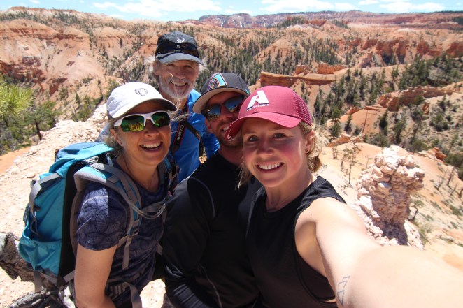
FairyLand Loop with Dee and Jeff!
From here we headed straight for Zion National Park. I would recommend staying another night in Bryce if you can, but because we didn’t have anything booked and had time to drive we headed for Zion National Park! We also really wanted to get there before the weekend hit (so wanted to wake up on a Friday to get in Angels Landing!
May 3rd
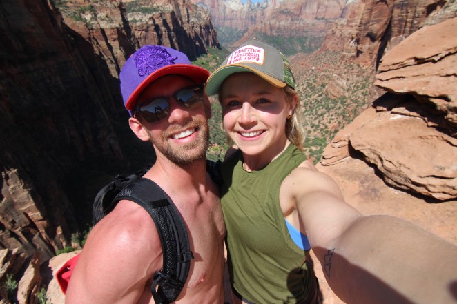
Angels Landing – Zion National Park
I had been to Zion National Park before and was SO excited to come back. It’s extremely busy in Zion in the Summer months, the last time I had visited was over 2 years prior, in February, so this was a bit of a wake up call. Though there is a reason it’s popular… it’s BEAUTIFUL. The whole drive into Zion I was silent, the red rock and massive rock walls literally take your breathe away. It’s like no park I have ever been to.
We never reserved camping in Zion National Park, so were unable to stay in the park, but were able to find some BLM land just 20 mins outside the park. We camped there for two nights, which ended up being a blessing, as downtown Zion can get very crowded and loud during the day and evening – out in the BLM land we felt like the only people around.
BLM Land
Thursday night (3rd) we went to bed early knowing we wanted to get up EARLY to get on the first shuttle up to Angels Landing (the most popular hike in the park). The first shuttle leaves at 6am from the visitor center so we planned to get to the parking lot for 515 – once we arrived there was already many lined up. We were able to get on the first shuttle. I highly suggest getting here very early if you want to get up before the heat of the day and avoiding waiting in the line for a long time. From 6-8 shuttles run into the canyon every 15 minutes. There are a number of stops along this route – so be sure to look ahead in advance to see what else you may want to stop and see along the way. If you are feeling eager, you can bike or hike into the canyon before 6am, which also avoids the crowds. The trail starts at the Grotto shuttle stop.
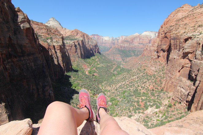
Angels landing is a 4.1 mile out and back trail, rated strenuous with 1617ft of elevation gain. It is not for the faint of heart… and should be approached with some hesitation, not only because of its narrow paths and steep drops but cause of the ‘busyness’ of the trail. On our way down there were HUNDREDS of people on the trail and we had to wait at various points to allow those coming up to pass the narrow trail, then those heading down to do the same. With steep drop offs on both sides it can be dangerous if not careful. The first 2 miles are well maintained and paved, then you enter ‘Walters Wiggles’, 21 steep switch backs, which takes you to scouts landing, before you begin the last half mile up to Angels Landing itself. Some people just take the hike to this point and not continuing on the last half mile. Be sure to avoid hiking this trail when its wet, raining, in a storm or when there are strong winds. Safety first!
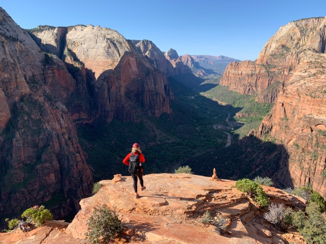
Angels Landing

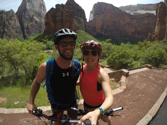
We finished the hike in the later morning and from there headed into town (Springdale) to walk around and check out what was around. We grabbed lunch and went to some of the shops – and ended up spotting a bike rental place. We got to bike rentals for $40.00, for three hours. I highly recommend doing this, as it is a GREAT way to see the canyon. You get exercise, and are able to get off and on as you please, stopping at different little sites and hikes along the way. They supplied us with helmets and a bike lock. Worth every penny!
Since we were camping out in BLM land we went to ‘Zion Outfitter’ for a shower. There is one place in town that offer public showers, for around $5.00, they also do laundry. We went out camped, and played cards. Listening to the sound of the crickets as we fell asleep.
May 4th
Our last day! Can’t believe how quick this trip went. We got up early, enjoyed the sunrise and headed for the Canyon Overlook, another little hike before hitting the road. The hike was on our way out of the park, so it worked out nicely. It is a quick 1.0 miles out and back trail, with only 213ft of elevation gain it is good for all skill levels and offers a wonderful view of the canyon. We played around with some of the canyons with handstands! On travel days I feel I always need to get a run in, or some sort of workout before sitting for many hours.
Canyon Overlook
After the hike we heading for Spanish Fork again, where we spent time with Craig’s family and enjoyed a good shower and a nights rest before continuing North back to Red Deer the next day.
If you have ANY questions regarding any of the hikes, places we stayed, packing list etc. feel free to message me through email b7.willson@gmail.com or on instagram @brookewillson.
Thanks for reading!`

Looks like an awesome trip. My Brother and I are leaving for Zion and south utah this coming weekend for 7 days. Any suggestions for the area. We have Angels, narrows and a few others.
Any info would be greatly appreciated
LikeLike
Canyon lookout is a good one and observation point! If you can make your way to Bryce Canyon national park I’d do that!
LikeLike
Utah is so sick! glad you guys got to explore all the parks there! Thank you for sharing!
LikeLike